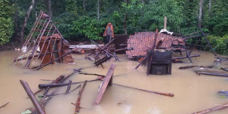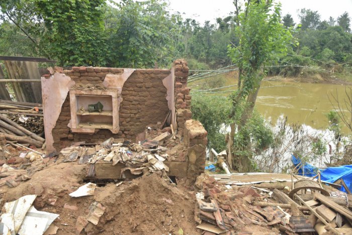
The submergence of hundreds of houses on either side of Cauvery river in Virajpet taluk may only be the beginning of a major disaster in riparian states as destruction of river ecology and encroachment of buffer zones have made the region vulnerable to climate change.
Entire villages have washed up within 100 meters from the river basin, with the distance between the house and the river reduced to about 10 feet at Bethri, Karadigodu, Guhya and Kondangeri. As flood survivors complained about the damage, Cauvery flowed quietly, taking the rejects from the houses pushed into its basin.
A study by Environment Management and Policy Research Institute (EMPRI) submitted to the government last year shows that the encroachment and construction activities in the 300-meter buffer zone on either side of the river poses a serious threat to both the river and people dependent on it.
To analyse land use, the study relied on satellite data, census maps which were verified with GPS-based data from the ground. Tracking change in land use and land cover along the buffer zone in Karnataka, experts saw that the built-up area alone increased by 941.05 acres between 2003-04 and 2014-15. “Built-up (rural area) expanded by 77% and built-up (urban area) expanded by 31%. This is identified as prominent change. In Kodagu, the total built-up area along the buffer zone jumped from 3% to 8%,” the study says.
Principal Chief Conservator of Forests (EWPRT) Ritu Kakkaar, who headed the working group that conducted the study, said the absence of a law to monitor the buffer zones should be rectified. “The 300-meter standard buffer zone should be monitored constantly. Any development activities in that area should be restricted and sand mining should be stopped immediately. These are major reasons contributing to floods,” she said.
There are 260 villages, 168 in upper Cauvery sub-basin and 192 in mid sub-basin and some, as seen in Virajpet, have come up within 100 meters of the river. Besides encroaching the buffer zones, the human activity has also eroded the river ecology.
The study has also raised concerns over the lack of coordination in monitoring water quality of the river. While the water quality data by Central Pollution Control Board revealed that 24.6% of Cauvery river stretch in Karnataka has been polluted and is unfit to drink without proper treatment, the Karnataka State Pollution Control Board data put the water quality at Class C (fit for drinking) for years. The central body’s number puts the water in Class E category.
Worryingly arsenic, chromium, copper, cadmium, zinc and lead were found in river water and the study attributed this to the human activities through industrial effluents, sewage and automobile wastes.
Minister S Suresh Kumar said he has already proposed shifting of the flood-hit villages located on river banks. “I have urged the zilla and town panchayats to pass a resolution to shift them to alternative houses in safe zones, instead of awarding compensation. Ultimately, people have to be taken into confidence,” he said.
The minister said he has told district officials to stop the flow of raw sewage into the river in Kushalnagar and set up a treatment plant at the earliest.
source: http://www.deccanherald.com / Deccan Herald / Home> State / by Chiranjeevi Kulkarni / DH News Service / Virajpet (Kodagu District) / August 23rd, 2019
